
h 3:00
Tempo di Percorrenza
8,00 Km
Lunghezza Percorso
310 mt
Dislivello
Sul lato occidentale del parcheggio si imbocca una strada sterrata percorsa
dall'Alta Via dei Monti Liguri, che presto si biforca. Entrambe le diramazioni sono
segnalate come AVML, ma conviene imboccare quella di sinistra perché effettua
un giro molto più breve.
Presto si abbandona la carrareccia per imboccare un sentiero che si innalza nel
bosco di latifoglie, prima misto, poi a prevalenza di faggi.
Tagliando verso destra ci si congiunge ad una mulattiera più ampia, quindi si
incrocia una pista forestale e, dopo un tratto assai rovinato dall'erosione, si sbuca
su una selletta dove i i due percorsi lasciati in precedenza si ricongiungono.
Si sale verso sinistra su carrareccia, prima lungo la cresta boscosa, poi sul versante
orientale per aggirare il piccolo dosso del Monte Sebanco.
La strada battuta taglia lungamente con brevi saliscendi nei pressi dello
spartiacque, poi diventa sentiero, e scavalca la poco pronunciata vetta boscosa
del Monte Banco.
Con una discesa più ripida tra gli alberi si raggiunge il Colletto Banco, dove si
incontra il segnavia “quadrato rosso pieno” proveniente dalla Sella Alzabecchi.
Salendo brevemente si esce in una bella radura dove il sentiero si biforca: si lascia
a destra l'AVML, che taglia verso il Colle Scravaion, e si imbocca a sinistra il
sentiero segnalato con il quadrato rosso, che rientra nel bosco e sale molto
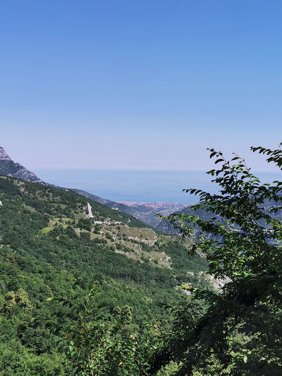
ripidamente. Aggiriamo una cima, superando alcuni bei punti panoramici, poi si
sale in diagonale fino ad una selletta all'inizio della cresta sommitale della Rocca
Barbena.
Si taglia ora sul versante marittimo e si sbuca presto all'aperto. Si rientra nel
bosco cosparso di massi per aggirare il dosso successivo, poi si scende
brevemente e si riprende a salire e, aggirata l'ennesima anticima sul lato padano,
si esce all'aperto guadagnando la cima della Rocca Barbena (1142 m).
Ripercorreremo poi lo stesso percorso a ritroso per tornare all'auto.
On the western side of the car park there is a dirt road followed by the Alta Via dei
the Alta Via dei Monti Liguri, which soon forks. Both branches are marked
marked as AVML, but it is better to take the one on the left because it makes a
a much shorter route.
You soon leave the cart track to take a path that rises through a broadleaf forest, at first mixed
deciduous forest, at first mixed, then predominantly beech.
Cutting off to the right, the path joins a wider mule track, then crosses a forest track.
then crosses a forest track and, after a stretch that has been ruined by erosion, comes out on a small
you come to a saddle where the two paths you left behind rejoin.
Climb up to the left on a cart track, first along the wooded ridge, then on the eastern slope to get around the
then on the eastern slope to get round the small ridge of Monte Sebanco.
The beaten road cuts across the watershed for a long time, with short ups and downs, then becomes a path.
watershed, then becomes a footpath, and climbs over the slightly pronounced wooded peak of Monte Banco.
of Monte Banco.
A steeper descent through the trees leads to Colletto Banco, where you will find the
where you meet the "full red square" signpost coming from the Sella Alzabecchi.
Climbing briefly, you come out into a nice clearing where the path forks: leave the AVML on the right, which
right of the AVML, which cuts towards Colle Scravaion, and take the path marked with the red square on the left, which
marked with a red square, which enters the wood and climbs very steeply.
steeply. We go around a summit, passing some beautiful panoramic points, then we
then climb diagonally up to a saddle at the beginning of the summit crest of Rocca
Barbena.
We now cut across the sea side and soon come out into the open. Re-enter the wood
boulder-strewn wood to get round the next ridge, then descend briefly and start climbing again.
then descend briefly and start climbing again and, having gone round the umpteenth peak on the Po side, come out into the open
you come out into the open, gaining the summit of Rocca Barbena (1142 m).
We will then retrace the same route back to the car.
Gallery percorso


